map making
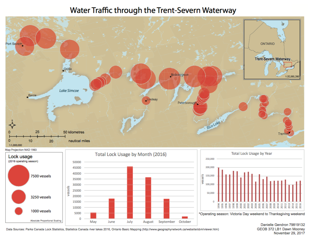
This past term I took a cartography course (today was the last class). This course introduced me to a different way to imagine the world, particularly my future field site. For the final project we were to make a quantitative thematic map. I began to visualize my field site from a different view point, as a map maker rather than an ethnographer. Having never been to/through this site it allowed me to begin to imagine how this waterway is used by people (and water vessels), and the sites along it which are utilized more frequently. Below is the map I submitted for assignment today (it looks incredibly different when printed out. siiiigh). Originally, I had hoped to include more information on this map to show where along the route provides the most seclusion (or feeling of being in the wild) by way of including population density, roadways, Provincial and National Parks, but having to submit a map on a letter size print out made a map displaying all of this information much too cluttered, unorganized, and difficult to understand. So I focused on the lock system. And here it is.....
The
process of map making has been an incredibly rich experience in terms
of interrogating and planning my future work. The creative process of
cartography informing ethnographic work, particularly my own, is worthy
of a far more extensive discussion. For now I share these brief thoughts
while I ruminate on this process and how I can further use it as a tool in my own work.
Comments
Post a Comment